Bug report #2227

GPS Tools: "Import other file" doesn't work
| Status: | Closed | ||
|---|---|---|---|
| Priority: | Low | ||
| Assignee: | |||
| Category: | C++ Plugins | ||
| Affected QGIS version: | Regression?: | No | |
| Operating System: | Windows | Easy fix?: | No |
| Pull Request or Patch supplied: | Resolution: | fixed | |
| Crashes QGIS or corrupts data: | Copied to github as #: | 12287 |
Description
1) GPS Tools -> Import other file
2) Browse -> choose 'shapefile' format and open point shapefile
3) Set feature type to 'Waypoints'
4) Type layer name and GPX output file and press OK
At result we have error message: "The layer is not a valid layer and can not be added to map"
Associated revisions
fix #2227
git-svn-id: http://svn.osgeo.org/qgis/trunk/qgis@15784 c8812cc2-4d05-0410-92ff-de0c093fc19c
fix #2227
git-svn-id: http://svn.osgeo.org/qgis/trunk@15784 c8812cc2-4d05-0410-92ff-de0c093fc19c
History
#1
 Updated by Giovanni Manghi over 16 years ago
#2
 Updated by Maxim Dubinin over 16 years ago
no, this tool still doesn't work.
There is no error message now, but progress bar is endlessly running.
#3
 Updated by gjm - almost 16 years ago
- Status changed from Open to In Progress
#4
Updated by gjm - almost 16 years ago
I can reproduce this problem if I don't select shapefile in the file selection dialog. If I do select shapefile, my test file converts and loads fine.
I'll have a look at making that need more obvious, and perhaps a little more automatic.
#5
 Updated by Alexander Bruy over 15 years ago
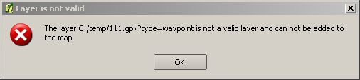
Tested with 5aed037f (SVN r15016) under Linux and all works fine. But on Windows with same revision and same data I get error
The layer D:/test.gpx?type=waypoint is not a valid layer and can not be added to map
#6
Updated by Maxim Dubinin about 15 years ago
issue is still present:
http://gis-lab.info/images/screenshots/20110417-120-11kb.jpg
#7
 Updated by Jürgen Fischer about 15 years ago
- Status changed from In Progress to Closed
- Resolution set to fixed
fixed in b47dfe5c (SVN r15785).
#8
 Updated by dr - about 15 years ago
- Status changed from Closed to Feedback
- Resolution deleted (
fixed)
If try to import any vector data into GPX QGIS throws an error. For example:
Could not import data from C:/personal/next/histmonumreg.geojson!

Input type 'copilot' not recognized
#9
Updated by Jürgen Fischer about 15 years ago
- Resolution set to fixed
- Status changed from Feedback to Closed
Replying to [comment:10 dr]:
If try to import any vector data into GPX QGIS throws an error. For example:
> Could not import data from C:/personal/next/histmonumreg.geojson!
>
> Input type 'copilot' not recognized
You can only use the file types listed in the selection dialog - and it's important to choose the one that matches your selected file. Seems you left the file type at 'copilot'.
But gpsbabel (or just the plugin) doesn't support GeoJSON anyway.
#10
Updated by Alexander Bruy about 15 years ago
- Status changed from Closed to Feedback
- Resolution deleted (
fixed)
Just tried to import shapefile with GPS Tools. Other files tab, select point shapefile and Shapefile (*.*) from file type combo. After clicking Ok button I get error message
Could not import data from F:/samples/shape/poi-osm.shp!

Input type 'shape' not recognized
Windows XP, . In Linux with same revision and same test data all works fine
#11
Updated by Alexander Bruy about 15 years ago
Here is screenshot [http://gis-lab.info/share/DR/gpxconvert.png]
#12
Updated by Jürgen Fischer about 15 years ago
- Status changed from Feedback to Closed
- Resolution set to fixed
Replying to [comment:12 alexbruy]:
Just tried to import shapefile with GPS Tools. Other files tab, select point shapefile and Shapefile (*.*) from file type combo. After clicking Ok button I get error message
> Could not import data from F:/samples/shape/poi-osm.shp!
>
> Input type 'shape' not recognized
Windows XP, . In Linux with same revision and same test data all works fine
your gpsbabel probably doesn't support shape.