Feature request #12474

Automate label rotation within polygon
| Status: | Closed | ||
|---|---|---|---|
| Priority: | Normal | ||
| Assignee: | - | ||
| Category: | - | ||
| Pull Request or Patch supplied: | No | Resolution: | invalid |
| Easy fix?: | No | Copied to github as #: | 20622 |
Description
ArcGis has a label placement option "always straight" that automatically rotates the labels within polygons for the best fit. This is especially useful for parcel numbers around the ends of cul-de-sacs, and parcels that are tall and narrow.
I know I can manually rotate each label, but I maintain a map with over 6000 labeled parcels and it would be extremely time consuming. A feature to automate this would be excellent.
History
#1
 Updated by Regis Haubourg almost 11 years ago
Hi,
"Free (slow)" option of polygon labeling looks like what you need. It can indeed be very slow. Do you confirm this works as expected?
#2
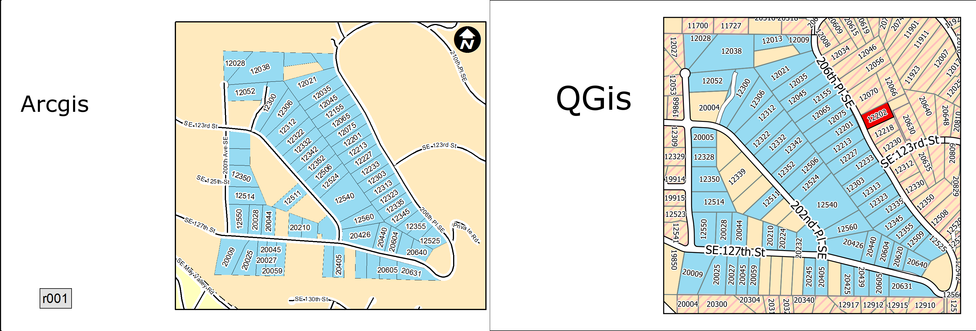
 Updated by Jesse McMillan almost 11 years ago
- File output_1.png added
Wow, can't believe I didn't notice it was already implemented. Thank you.
I will say, the label locations aren't quite as consistent as arcgis, which could perhaps be improved.
However, QGis does a better job labeling as many polygons as possible (where arcgis leaves some blank.)
noticed the attached image for a comparison.
In any case, it works for me. Thanks again.
#3
 Updated by Nyall Dawson almost 11 years ago
- Resolution set to invalid
- Status changed from Open to Closed